Popular destination of himachal pradesh
(1) shimla - Height: Most of the town lies between 2,100 m and 2,300 m
Languages spoken: Hindi. Also English, Punjabi and Pahari.
Religion: Mostly Hindu. Also Sikh, Muslim and Christian
Medical Facilities: Good
Telecommunications: Worldwide links by the net, telephone and fax, code: 0177

With all its intricacies, history seems to have been the mortar for every brick and stone that has built Shimla. As the Summer Capital of the British in India, Shimla was the country's focus for the better part of every year and now, is the state capital of Himachal Pradesh. The town of Shimla rose in the nineteenth century when the Gurkha Wars came to an end in 1815-16 and the victorious British decided to retain certain pockets as military outposts and sanitaria. In 1822 the most rigorous of dandies and the greatest of sticklers for form Captain Charles Pratt Kennedy, Political Agent to the Hill States directed that a house be built for him at the village whose name is variously reported as Sheyamalaya Shumlah, Shimlu and Shemlah. Kennedy House led the vanguard of the hundred-odd houses that were to scatter themselves by 1841 over every level or gently inclining space. Lured by the climate and terrain scores of European invalids began moving to the station and the only stipulation of the local chief who owned the land was that no tree be cut or cattle slaughtered.
In 1864 the Viceroy, John Lawrence anointed Shimla – then spelt Shimla, as the summer capital of British India. With Lawrence came the Viceroy Council, the Imperial Secretariat, representatives of the Indian princes and foreign envoys. As the town grew to become the workshop of the Empire, an awed visitor observed, every pigeonhole cradled an embryo of a war or death. Despite the fact that up to the time of Indian independence in 1947, Shimla officially remained only the summer capital, yet the Government spent more time in these hills than at the actual capital Calcutta and later New Delhi. As the bearer of the Vice regal scepter this tiny pocket became the cynosure of British Empire. Imperial grandeur, and all the panoply and trappings of power came along for the ride. And there was a popular local saying that went, “You cannot sleep the nights in Shimla for the sound of grinding axes”. A social whirl of parties, gymkhanas, balls, fancy fairs and affaires du Coeur ensured that a heady mixture of scandal and intrigue constantly wafted through the town.
where to stay - Shimla has accommodation to suit most types of budgets and tastes. However other towns near Shimla mostly have limited options including HPTDC guest houses which provide a comfortable stay at reasonable prices. Details are available from local tourist offices
Sufficient accommodation is available in Hotels of HPTDC.
how to reach -By Road - Broad well surfaced road connects to Kalka, Chandigarh, Delhi, etc.
By Rail - Broad gauge track upto Kalka connecting to Delhi, Kolkata and Amritsar. Narrow Gauge from Kalka to Shimla
By Air - Daily Flights from Delhi and Kullu. Airport at Jabbarhatti 23 kilometers from the city.
(2) manali - Height: 2,050 m
Languages: Hindi, Pahari, Punjabi, English

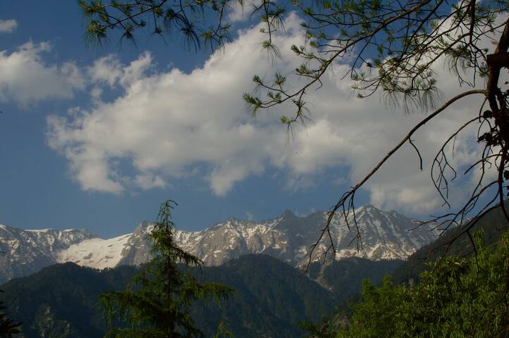
Just 40 Km away from Kullu to the north, Manali is situated near the end of the valley on the National Highway leading to Leh. The landscape here is breath- taking. One sees well-defined snow capped peaks, the Beas River with its clear water meandering through the town. On the other side are deodar and pine trees, tiny fields and fruit orchards. It is an excellent place for a holiday, a favorite resort for trekkers to Lahaul, Spiti, Bara Bhangal (Kangra), and Zanskar ranges. From temples to antiquity, to picturesque sight-seeing spots and adventure activities, Manali is a popular resort for all seasons and for all travelers.
where to stay - Kullu has accommodation to suit most types of budgets and tastes.
HPTDC guest houses provide a comfortable stay at reasonable prices. Details are available from local tourist offices
how to reach - By Road - Manali is well connected by road with Delhi, Ambala, Chandigarh, Dehradun, Haridwar, Shimla, Dharamsala and Chamba/Dalhousie. Deluxe, semi-deluxe and air conditioned buses run during the tourist season. It is connected with Leh during July to October.
By Rail - Broad gauge trains travel upto Pathankot, from where a narrow gauge train takes you to Jogindernagar. The Jogindernagar-Mandi distance of 55kilometers can be covered by road .
By Air - The airport at Bhunter is 50 km from Manali where taxis and buses are available.
(3) kullu - Height: 1,230 m
Area: 5,503 sq.kms
Population: 3,81,571
Languages: Hindi, Punjabi, Pahari, English are understood and spoken by the people engaged in tourism trade

The most charming and beautiful Kullu valley spreads out its charm on either side of river Beas. The valley runs north to south of this river and is 80 km long and about 2 km at its broadest. Yet with awe inspiring glens and mossy meadows encircled by the rushing streams and meandering brooks, flung east & west, a fairly wide area is open to the tourists, the trekkers, the mountaineers, the artists and to anyone who wishes to escape the heat & dust of the plains to breathe the exhilarating air of the Himalaya and enjoy the spectacle of the variegated mountain scenery. The valley is also famous for its exquisitely woven colorful handmade shawls and Kullu caps.
where to stay - Kullu has accommodation to suit most types of budgets and tastes.
HPTDC guest houses provide a comfortable stay at reasonable prices. Details are available from local tourist offices
how to reach - By Road - Kullu is well connected by road with Delhi, Ambala, Chandigarh, Shimla, Dehradun, Pathankot, Dharamsala & Dalhousie etc. Regular direct buses ply between these stations including deluxe, semi-deluxe and air conditioned buses during tourist season.
By Rail - Nearest convenient rail heads are Kiratpur and Chandigarh on Broad Gauge and Jogindernagar on Narrow Gauge from where Kullu can be reached by road.
By Air - Kullu is connected by Indian Airlines and Air Deccan with Delhi & Shimla. The airport is at Bhuntar, 10km from Kullu.
(4) dharamshala - Height: Between 1250 m to 1550 m
Area: 5739 sq. Km.
Population: 13.39 lakh
Languages: Hindi, Punjabi, English and Pahari are understood and spoken by the people engaged in tourism trade

This is a hill station lying on the spur of the Dhauladhar range about 17 Km north- east of Kangra town. This hill station is wooded with oak and conifer trees and snow capped mountains enfold three sides of the town while the valley stretches in front. The snowline is perhaps more easily accessible at Dharamsala than at any other hill resort and it is possible to make a day's trek to a snow-point after an early morning's start. Dharamsala is also the headquarters of the Kangra district.
where to stay - HPTDC hotels, private hotels and guesthouses, PWD and Forest Rest Houses, are there in and around Dharamsala. Details are available from local tourist offices
how to reach - By Road - Direct and regular bus service from Delhi, Chandigarh, Jammu , Shimla , Chamba and Manali
By Rail - Pathankot is the nearest broad gauge railway terminal to Dharamsala. From Pathankot there is a narrow gauge railway line up to Kangra (94 Km) and from here Dharamshala is 17 Km by road.
By Air - Nearest airport is Gaggal.
(5) solan - Height: 1,350 m
Area: 1936 sq. Km
Population: 5.00 lakhs
Languages: Hindi, Punjabi, English are understood and spoken by the people engaged in tourism trade.
Blessed with a pleasant climate all the year round, Solan has the district headquarters and has the famous temple of Shoolini Devi. From Solan, Jatoli village and the temple of Lord Shiva and on Rajgarh road the Buddhist Dolanji Bon Monastery may be visited. Known as the "Mushroom city of India", Solan has an old brewery and a sprawling horticulture and forestry university at Nauni. Rajgarh is full of orchards that grow stone-fruit like plums, apricots and peaches; en route you may stop for fishing at Gaura
where to stay -Solan has accommodation to suit most types of budgets and tastes. HPTDC hotels at Barog and other private hotels and restaurant are available at Solan.
HPTDC guest houses provide a comfortable stay at reasonable prices. Details are available from local tourist offices.
how to reach - By Road - Solan is approachable by road from Shimla and Chandigarh.
By Rail - The nearest broad gauge railway station is at Kalka and nearest narrow gauge railway station is at Solan, which is connected by regular bus services.
By Air - Nearest airport is at Chandigarh.
(6) mandi - Height: 960 m
Area: 3950 sq.
Population: 9.01 lakh
Language: Hindi, Pahari, Punjabi and English

The historic town of Mandi is built along the banks of the river Beas. It has long been an important commercial centre and the sage Mandva is said to have meditated here. This one time capital of the princely state of Mandi is a fast developing town that still retains much of its original charm and character. Today, it is a district headquarters. Mandi is renowned for its 81 old stone temples and their enormous range of fine carving, it is often called the 'Varanasi of the Hills'. The town has remains of old palaces and notable examples of 'colonial' architecture. The temples of Bhootnath, Trilokinath, Panchvaktra and Shyamakali are among the more famous ones. The week long international Shivratri fair in Mandi is the major attraction of the area every year. In the year 2013 the fair was celebrated in March. In the fair the activities like cultural programmes in the evenings, exhibitions, sports etc. attract the tourists as well as locals.
where to stay - Mandi has accommodation to suit most types of budgets and tastes. HPTDC guest houses, rest Houses, hotels & home stays provide a comfortable stay at reasonable prices. Details are available from local tourist offices.
how to reach - By Road - Mandi is approachable by road from Shimla (145 Kms), Chandigarh (205 Kms) and Delhi (450 Kms). There are regular bus services linking it to the other towns like Manali, Palampur and Dharamsala.
By Rail - Broad gauge train travels upto Pathankot, from where a narrow gauge train takes you to Joginder Nagar- Mandi distance of 55 Kms can be covered by road.
By Air - Nearest airport is at Bhuntar, 31 Km from Mandi.
(7) spiti - valley -
Height: 4,570 m

Spiti is the sub division of Lahaul & Spiti district with its headquarters at Kaza. Spiti also means "Middle Country". It is called "Little Tibet" because it has almost the same terrain, vegetation and climate. Some inhabitants have adopted Buddhism as their faith and Bhoti is the spoken language. The people are simple and honest. It lies between Tibet, Ladakh, Kinnaur, Lahaul and Kullu. From Shimla via Kinnaur there is a motorable road which remains open up to Kaza for 8 to 9 months. About 10 Km. ahead of Pooh, Satluj enters India near Shipki la & Spiti River joins it at Khab. The road then goes to Sumdo via Hangrang valley. From Sumdo Spiti valley starts. The Spiti River flows fast through deep gorges at some places. It has an area of 4,800 sq. Km. The main Spiti valley is split into eastern and western valleys. They are connected with Ladakh and Tibet on eastern side & Kinnaur and Kullu on western side through high passes.
where to stay - Small hotels and camps at Tabo, Kaza and Kibber. At Kaza, Himachal Tourism runs the Tourist Lodge. Medical facilities are available at Kaza, Tabo, Sagnam and Kibber. All prescription medicines should be carried along. While travelling to the higher areas, adequate medical precautions should be taken.
how to reach - By Road - From Manali to Kaza there are regular buses from July to October. From Shimla via Kinnaur there are regular buses from May to October.
By Rail - Jogindernagar is the nearest railway station. The rail route from Jogindernagar to Chandigarh is a narrow guage one. Shimla and Chandigarh are the nearest broad guage railway stations. Buses and taxis are available from Shimla and Chandigarh to reach Spiti.
By Air - Spiti can be reached either from Manali or via Shimla. Buses and taxis can be hired from Manali to Kaza. Flights from New Delhi, Chandigarh and Kullu operate on a daily basis to Shimla airport.
(8) dalhousie - Height: 2,036 m

Dalhousie (2036 m) is a hill station full of colonial charm that holds lingering echoes of the Raj. Spread out over the five hills (Kathlog, Potreys, Tehra, Bakrota and Balun) the town is named after the 19th century British Governor General Lord Dalhousie. It was popular with the British Army personnel in 1860's. The town’s varying altitude shades it with a variety of vegetation that includes stately grooves of pines, deodars, oaks and flowering rhododendrons. Rich in colonial architecture, the town preserves some beautiful churches. St. John church is the oldest one built in 1863, St. Francis was built in 1894, St. Andrew in 1903 and St. Patrick in 1909.
There are also magnificent views of Chamba valley and the mighty Dhauladhar range with its awe-inspiring snow covered peaks filling an entire horizon.
where to stay - Dalhousie has accommodation to suit most types of budgets and tastes.
HPTDC guest houses provide a comfortable stay at reasonable prices. Details are available from local tourist offices
how to reach - By Road - Dalhousie is approachable from Delhi, from Chamba via Banikhet and via Khajjiar. HPTDC buses are regularly available.
By Rail - The nearest railhead at Pathankot is 85 Km away.
By Air - Nearest airport is at Kangra.
(9) lahual -valley - Height: 3340 m (Keylong)
Area: 13835 sq. Km
Population: 33,224
Language: Lahauli, English, Hindi, Bhoti are understood and spoken by the people engaged in tourism trade.

Lahaul and Spiti are two remote Himalayan Valleys of H.P. lying on the Indo-Tibet border. Strange, exciting, primitive, these valleys are unsurpassed in mountain scape, in the rugged beauty of their rocky escapements and the splendour of their snow covered peaks. Lahaul is marked by a central mass of uniformly high mountains and massive glaciers. The two rivers, Chandra and Bhaga which rise on either side of the Baralacha La, flow through the narrow Chandra and Bhaga valleys. Lahaul is a land of fascinating Buddhist art and culture. The monasteries of Lahaul-Spiti are rich repositories of ancient murals, thankas, wood carving and golden images of Padmasambhava. The valley lies at a height of 2,745 metres above sea level. Summer in this valley is cool and pleasant with green grass and alpine flowers. There are little monsoon in both these valleys and this enables climbers and trekkers to enjoy a long and unbroken season in perpetual sunshine to explore the wilderness and grandeur of the inner Himalaya. This unique feature makes Lahul-Spiti as an ideal destination for tourists and trekkers in the month of July, August and September. Keylong is 115 Km from Manali and is the District Headquarters of Lahul-Spiti District. its character.
where to stay - Lahaul has accommodation to suit most types of budgets and tastes. HPTDC guest houses, rest Houses, hotels & home stays provide a comfortable stay at reasonable prices. Details are available from local tourist offices
how to reach - By Road - By road the distance is 115 Km from Manali, 188 Km from Kaza, 373 Km from Leh, 435 Km from Chandigarh and 690 Km from Delhi. Heavy winter snows cut off road connectivity to the region at Rohtang Pass for six months from November to June. Buses, Taxis are available from Manali in season. HPTDC also plies regular coaches to Leh via Keylong during July – September.
By Rail - The nearest station is at Shimla, around 290 Km from Lahaul.
By Air - The Nearest airport is Bhunter, 175 Km from Keylong.
(10) billaspur - Height: 1167 sq. Km
Population: 3.40 Lakh
Language: Hindi, Punjabi, English are understood and spoken by the people engaged in tourism trade.

Formerly the seat of the ruler of the State is now submerged in the Gobind Sagar; it was situated on the south east side of the Satluj. Bilaspur Township is situated just above the old town of Bilaspur at a height of 670 m. above sea level. The new Bilaspur Township can be truly described as the first planned hill town of the country. The pleasure of a visit will be enhanced manifold when a motor launch is preferred as the means of travel, gliding through cool and enchanting waters of the lake. The Nalwari or annual cattle fair is held at Bilaspur for four or five days in March / April, the occasion is marked by wrestling and other amusements. Cattle are brought from Nalagarh and neighbouring parts of Punjab. For accommodation, Himachal Tourism's Hotel Lake View and pvt hotels are available at Bilaspur.
where to stay - Bilaspur has accommodation to suit most types of budgets and tastes.
HPTDC guest houses provide a comfortable stay at reasonable prices. Details are available from local tourist offices
how to reach - By Road - Bilaspur is approachable by road from Shimla and Chandigarh.
By Rail - The nearest broad gauge railway station is at Kiratpur Sahib and nearest narrow gauge railway station is at Shimla.
By Air - Nearest airport is at Chandigarh.


